Routes and Maps
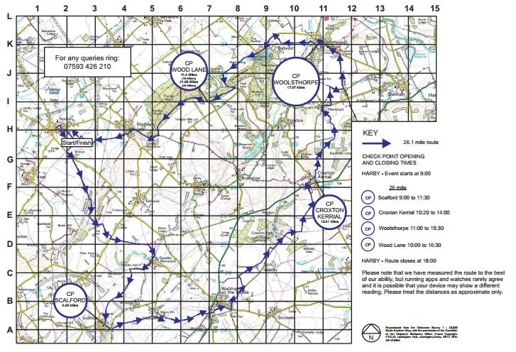
The 26 and 15 mile routes follow footpaths, byways, tracks and minor roads throughout the beautiful Vale of Belvoir and with the kind permission of the Duke of Rutland, goes through the Belvoir Estate. Both routes start and finish at Harby Village Hall but each year they are varied in order to keep it fresh and interesting for entrants. Routes are clearly way-marked with coloured tape. There are checkpoints approximately every 5 miles providing free drinks and snacks.
Ordnance Survey maps covering the area are:
1:50000 (Landranger) - 129 and 130
1:25000 (Explorer) - 246, 247 and 260
1:25000 (Pathfinder) - SK62/72, 63/73, 82/92 and 83/93
Routes for the next event will be available a few days before the start of the next Challenge. The routes will available to download in Map and GPX files. Please also download and familiarise yourself with the car park map below because parking is limited in Harby and your chosen car park may be full at the time of your arrival.
2024 Routes
Previous Routes
A copy of the full Risk Assessment can be viewed here
The routes below are from previous Challenges and can be downloaded but are listed for reference only.